
Practical facts
| Item | Information |
|---|---|
| Opening hours | Dunhuang Yadan Geopark: A Practical Visitor Guide opening sessions, weekly closures and final admission are as per the official notice for the travel date. Check the current operator announcement before setting the departure time. The cited official directory provides regional tourism context; it does not establish a current timetable for this individual stop. |
| Ticket / admission | Dunhuang Yadan Geopark: A Practical Visitor Guide admission, concessions and the inclusions of any selected visitor product are as per the official notice. Confirm separate transport, performance or activity charges before purchasing. |
| Time needed | Allow 2–3 hours for one permitted visitor-bus route and its signed viewpoints; excludes off-road wandering, a second bus product and the Dunhuang transfer. |
| Getting there | Use the confirmed Dunhuang Yadan Geopark: A Practical Visitor Guide visitor entrance and the current official arrival guidance. Agree the drop-off point and return route before leaving your accommodation; any local transport service is subject to its current notice. |
| Best time of day | Prefer a permitted later-afternoon route with a confirmed return bus; keep 20–35 minutes for the signed viewpoints while preserving daylight and the return connection (Vayora pacing estimate, not an operator timetable). |
| Booking required | Dunhuang Yadan Geopark: A Practical Visitor Guide reservations, available visitor sessions and any identification requirements are as per the official notice. Confirm the selected product and cancellation terms with the operator before travel. |
Visit durations, walking buffers and suggested arrival periods are Vayora planning estimates, not operator timetables or reservation deadlines. Prices, hours and access rules can change; confirm the current official notice before travel.
Source: official regional tourism context, checked October 5, 2026.
Why it matters
Overview
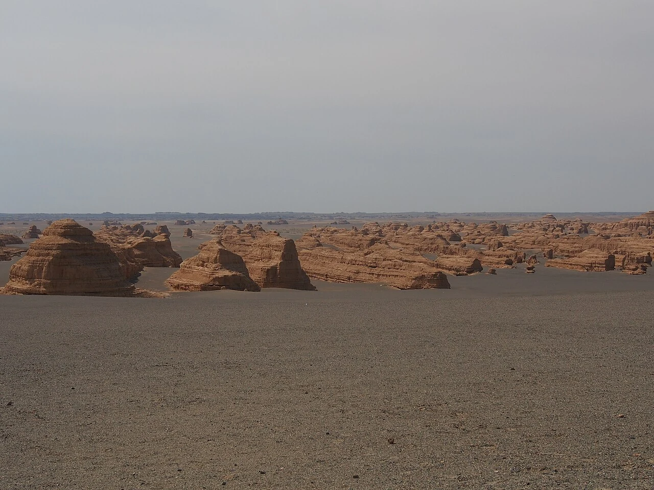
The Yadan landscape consists of ridges and towers shaped by long-term wind erosion in an extremely arid setting. Its scale is difficult to understand from a single photograph. The journey also reveals the emptiness and logistical challenges of the western approaches to Dunhuang.
The most useful way to approach Dunhuang Yadan Geopark is to connect the visible place with the wider geography and history of Dunhuang. A remote field of wind-eroded landforms on the western desert route from Dunhuang.
Build the visit
How to plan your time
Plan a long road day and confirm whether Yumen Pass or other frontier sites can be combined under current access rules. Services are limited, temperatures swing sharply and wind can alter conditions. The route should include water, sun and cold protection, and enough fuel and buffer time for the return.
Look more closely
What to notice
Wind erosion and the development of yardang forms. Pause long enough to understand this feature in place, and ask how it connects with the larger Dunhuang story rather than treating it as an isolated label.
The scale and isolation of the western desert. Pause long enough to understand this feature in place, and ask how it connects with the larger Dunhuang story rather than treating it as an isolated label.
How frontier sites relate to ancient route control. Pause long enough to understand this feature in place, and ask how it connects with the larger Dunhuang story rather than treating it as an isolated label.
Practical planning
Getting there and visiting responsibly
For Dunhuang Yadan Geopark, confirm the exact entrance and pickup point because a map pin may not represent the visitor gate.
Return to the Dunhuang city guide to place this visit in the wider trip.
Visitor FAQ
Before you go
What should I combine with this visit?
Choose a geographically related Dunhuang stop with a different purpose.